

Drone Survey Services for Aerial Mapping & Construction Documentation
Drone survey services help architects, engineers, and contractors achieve comprehensive aerial documentation of buildings and sites that would be impossible or unsafe to capture from the ground. By using FAA Part 107-certified remote pilots and advanced commercial drones, we deliver accurate, reliable aerial data that supports better planning, design, and construction decisions.
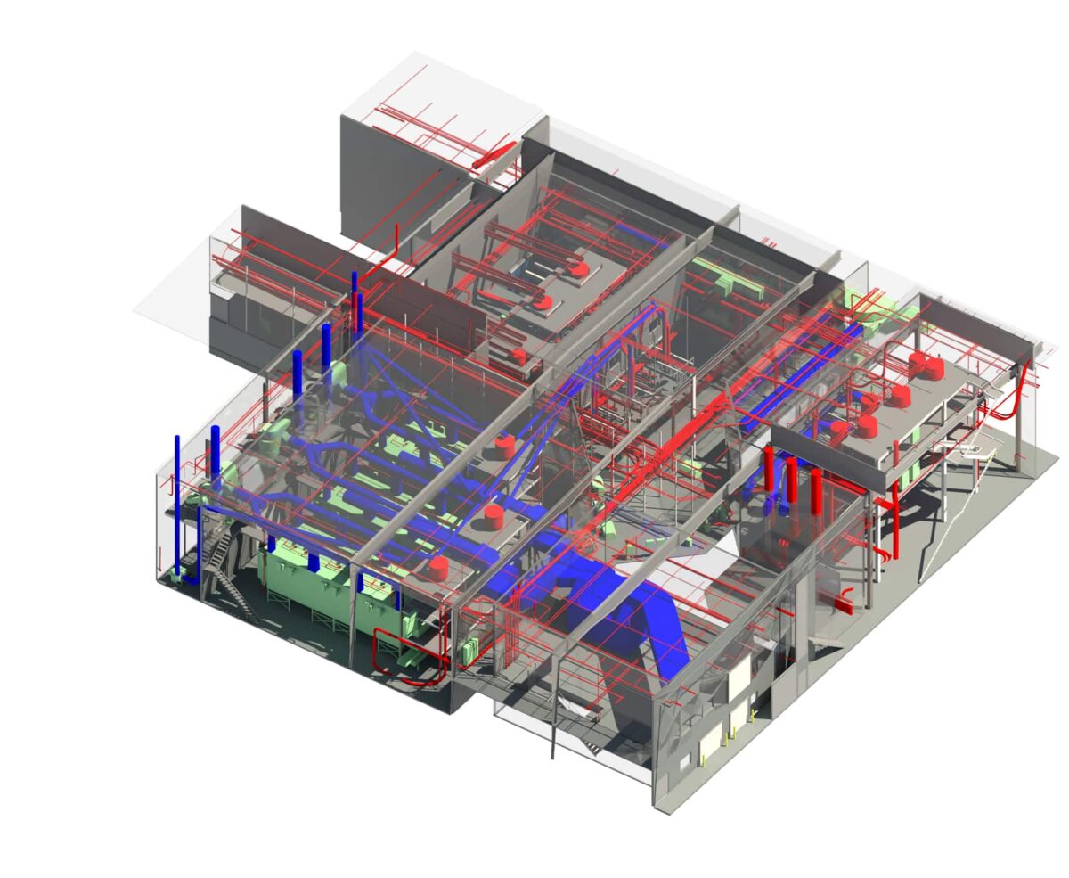
Crosley Tower's Aerial Drone Surveying
What is a Drone Survey?
A drone survey is the process of using unmanned aerial vehicles (UAVs) equipped with cameras and sensors to capture aerial imagery, photogrammetry data, and video of buildings, sites, and structures. It’s commonly used in architecture, engineering, construction, and real estate to improve coverage, safety, and accuracy of project documentation.
TrueScan’s Drone Survey Process
Flight Planning & Permitting
Our FAA Part 107-certified remote pilots assess your site and plan safe, efficient flight paths to capture hard-to-reach areas like rooftops, tall structures, and large campuses.
Data Capture & Processing
Using advanced drones, we collect thousands of high-resolution, overlapping images from multiple angles to ensure complete coverage of the space. Captured images are processed and stitched together using photogrammetry to create a cohesive, data-rich dataset.
Quality Assurance
Outputs are reviewed for completeness, georeferencing accuracy, and resolution before delivery. Any coverage gaps are identified and remediated.
3D Model & Map Generation
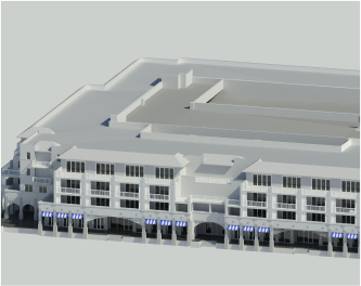
Our team converts the data into accurate 3D point clouds, maps, and models that allow you to visualize and measure any part of the space.
Delivery & Support
You’ll receive a comprehensive, drone-captured map of existing conditions, including areas that may be difficult or unsafe to access, giving your team a complete and accurate view of the site. Our team is available to answer questions and provide support to help you fully utilize the data.
Benefits of Drone Surveys
Save Time & Reduce Costs
Capture a cost-effective snapshot of existing conditions without extensive manual surveying, scaffolding, or repeat site visits.
Access Accurate, Current Data
Work from up-to-date, high-resolution imagery and data that reflects how your project actually exists today.
Survey More in Less Time
Cover large sites quickly and efficiently, capturing more data in a fraction of the time of traditional methods.
Capture Hard-to-Reach Areas
Document rooftops, tall structures, and restricted spaces that would otherwise be difficult or impossible to access.
Improve Safety & Reduce Disruption
Keep personnel out of hazardous environments and minimize interruptions to active job sites.
Who Uses Drone Surveys?

Architects
Architects use drone surveys to capture accurate site and building data, especially for rooftops and hard-to-reach areas, to support design and planning.

Developers
Developers use drone data for site evaluation, due diligence, and to gain a complete view of large or complex properties.

Engineers
Engineers rely on aerial data to assess structures, analyze site conditions, and support design decisions with accurate, real-world information.

Facility Managers
Facility managers use drone surveys to inspect roofs and building exteriors, reducing the need for manual inspections and improving safety.

General Contractors
General contractors use drone surveys to document job site progress, verify conditions, and plan logistics without disrupting active work areas.
Cost of Drone Surveys
TrueScan drone survey services typically range from $4,000 to $12,000+, depending on the size and complexity of the site, airspace restrictions, deliverable type (video, orthomosaic, 3D model), and the scope of processing required.
Timeline


Most drone survey projects at TrueScan are completed within 2 to 6 weeks from mobilization to final deliverable. Scheduling may be affected by weather conditions and airspace restrictions. We’ll provide a specific timeline with your proposal.
Related TrueScan Services

TrueScan Drone
Survey Services Nationwide

Atlanta | Chicago | Cincinnati | Columbus | Indianapolis | Orlando | Philadelphia | More
TrueScan Leadership
Considering our services? Our leadership team can provide you with answers to all of your questions. Connect with us today!

CEO, President
Brendan Welsh, PE, PS


Vice President, Existing Conditions
Jared White

Vice President, Acquisitions
Brandon French
Get a Free Quote
"*" indicates required fields
Get a Free Quote
"*" indicates required fields