See Hidden Areas With Drone Services & Photogrammetry

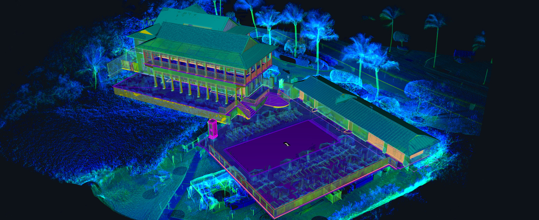
Designing based on outdated building plans and field measurements always has its challenges, but add in areas that you can’t see – like dangerous roof lines – and it becomes impossible. Whether it’s a dome-shaped roof, an incredibly tall building, or a sprawling campus, adding drone services, mapping, and photogrammetry can provide a more complete view of your project. 

TrueScan’s team includes multiple Certified Remote Pilots through FAA Part 107 with extensive experience in surveying and scanning with commercial drones. These pilots utilize advanced drones to make sure TrueScan’s clients have every bit of information they need, regardless of capture difficulty.

Crosley Tower's Drone Photogrammetry

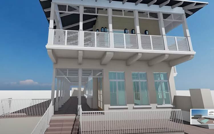
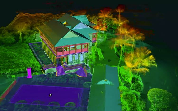
Your Project’s Journey from Scan to Reality

Average Price

$4,000-$12,000+

Prices vary based on many factors, read more about the factors that go into the price of your scanning service or get a quote today.

Average Timeline

2 – 6 weeks

With more precise details on the needs of your project, we can nail down an expected price and timeline.

Deliverables

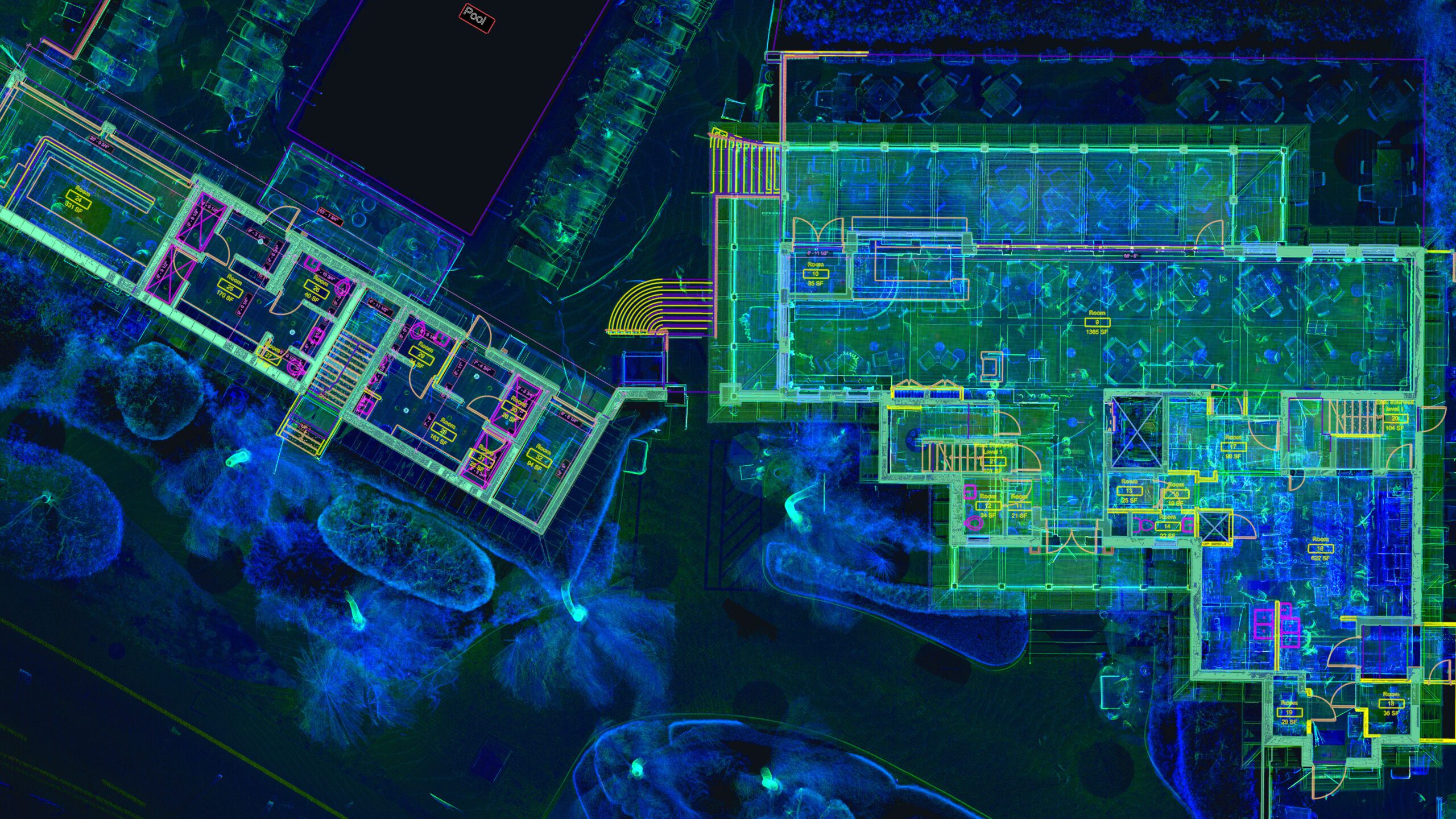
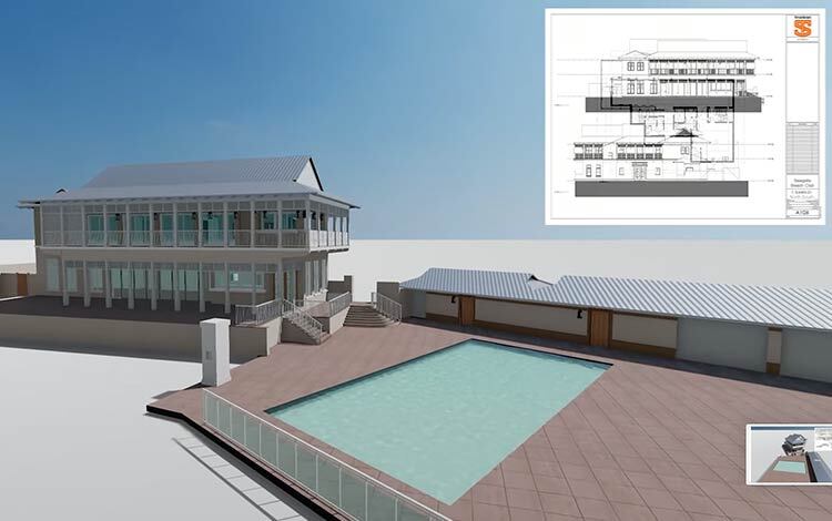
At the completion of this service, you’ll receive a comprehensive drone-captured scan of your existing building to capture areas you might not be able to safely access otherwise.

Benefits

  • Provides a cost-effective snapshot of the project as it actually exist
  • Latest and most accurate data
  • Capture details of the project you wouldn’t otherwise be able to reach
  • Increase safety by keeping people out of dangerous working conditions
  • Reduce the need to enter high traffic areas
  • Survey and capture much larger areas in a shorter time

Our Specialty:
Building Documentation

seagate banner seagate with plan truescan-3d-seagate-revit (1)

Not Our Specialty

small-obj
Small Objects
rev-eng
Reverse Engineering
doc
Documents
gpr
GPR

Ensure You’re Getting the Complete Picture

With TrueScan’s FAA-certified drone pilots, drone scanning and photogrammetry have never been easier. Our team can help you acquire the data you need in a timely, safe, and cost-effective manner.

To provide this data, a professional drone scans and captures thousands of high-resolution, data-driven photos of a space, regardless of size. These images overlap, connecting the data and visuals, and allow design professionals to view a space in a variety of different vantage points.

The images then are pulled together by a skilled TrueScan technician to create a detailed and precise 3D map of the client’s construction or design space. A design professional can use these 3D models and maps to measure any area of the space you can visualize. The measurements are incredibly accurate and can put the designer directly into the space without needing to be there physically.

What We Need From You

Let’s kickstart your project’s full potential with our top-notch scanning services. Share the key details below, and together, we’ll turn your vision into a reality!

  • Where is the project located? Can you give us a street address?
  • Do you have photos or floor plans?
  • Is the scan data for planning a renovation?
  • Do you need color scanning?
  • Do you need exterior or rooftop scanning?
  • Are there any above ceiling spaces that need scanning?
  • Are there special access considerations – badging, escorts, off-hours work?
  • Would you like a price to develop a Revit model?
    • If so, which building elements are required?
  • How soon do you need a proposal?
  • How soon do you need the work performed?

TrueScan Leadership

Considering our services? Our leadership team can provide you with answers to all of your questions. Connect with us today!

CEO, President

Brendan Welsh, PE, PS

Vice President, Existing Conditions

Jared White

Vice President, Acquisitions

Brandon French

Get a Free Quote

"*" indicates required fields

Get a Free Quote

"*" indicates required fields