
Accurate 3D Laser Scanning Services for Construction & Renovation
3D laser scanning services help architects, engineers, and contractors achieve precise documentation of existing conditions. By deploying high-density terrestrial scanners that capture millions of measurements per second, we deliver accurate, reliable point cloud data that supports better planning, design, and construction decisions.
What Is 3D Laser Scanning?
3D laser scanning is the process of using laser-based sensors to capture the precise geometry of a building, structure, or space as a dense point cloud. It’s commonly used in architecture, engineering, construction, and facility management to improve accuracy, efficiency, and collaboration across project teams.
TrueScan’s 3D Laser Scanning Process
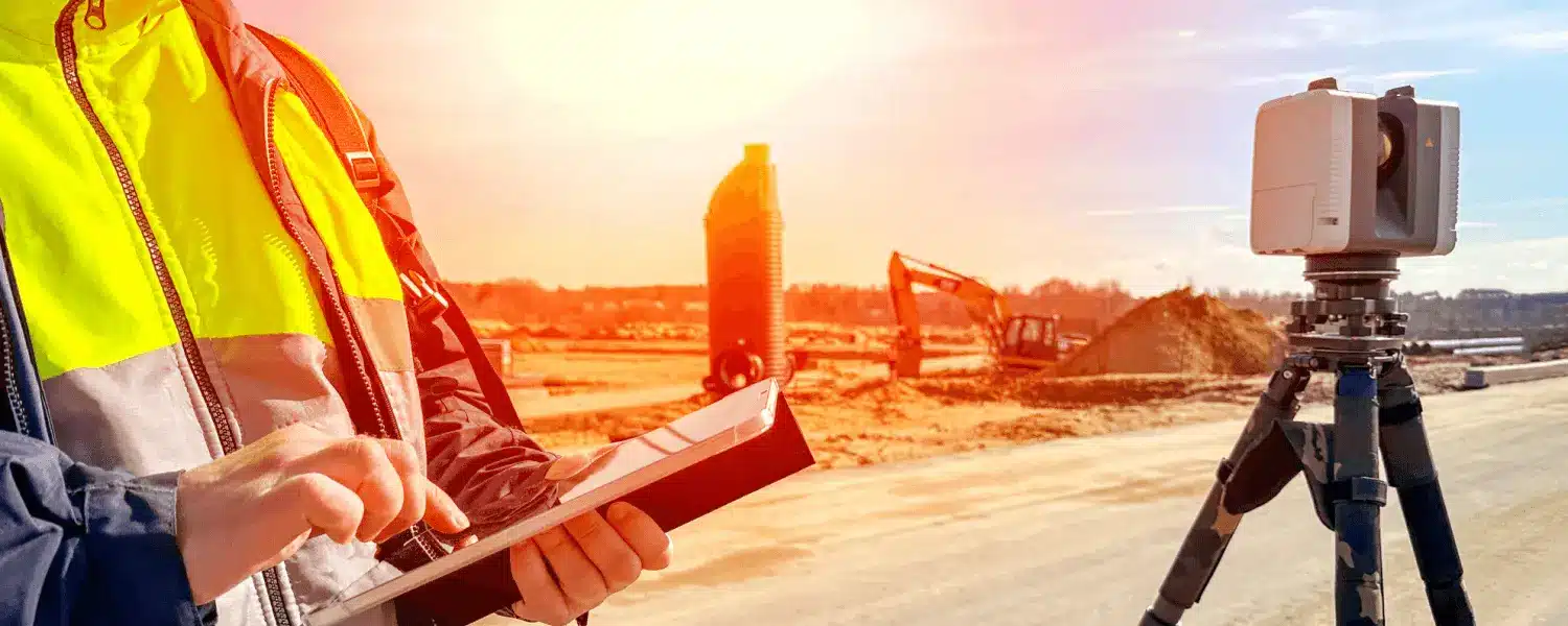
Data Capture
Our certified technicians use professional-grade 3D scanners to capture millions of precise measurements per second, documenting every surface, corner, and feature of your space, typically in a single visit with minimal disruption.
Data Processing
Scan data is processed and aligned into a unified, georeferenced point cloud using industry-leading software. Each scan is cleaned and checked to ensure full coverage and accuracy.
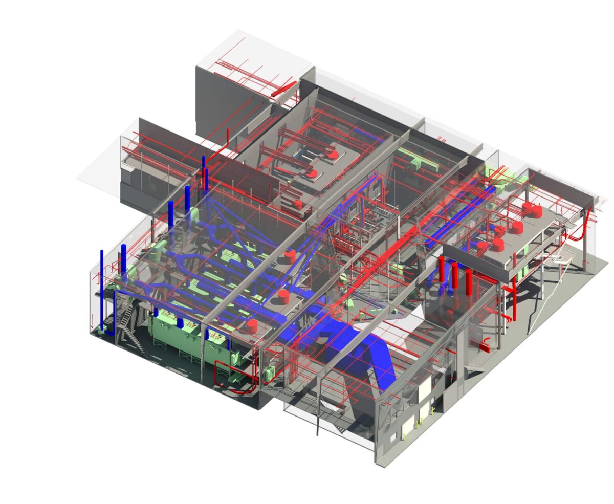
Model/Output Creation
Depending on your project needs, we transform data into your required deliverable(s), including: a raw point cloud, CAD drawing, Revit BIM models, or Matterport virtual tours. All outputs are created directly from measured data, not assumptions.
Quality Assurance
Every project undergoes a multi-step QA review to verify accuracy, check for data gaps, and ensure alignment with your project scope.
Delivery & Support
You receive a full digital map of your building that can be explored inside and out. Final files are delivered in your preferred format, ready to use, with onboarding support to help your team put the data to work immediately.
Benefits of 3D Laser Scanning
Reduce Change Orders
Design with accurate as-built data that reflects real field conditions, minimizing costly surprises and rework during construction.
Improve Accuracy
Capture spatial data at millimeter-level precision far exceeding the reliability of manual measurements.
Save Time
Complete all data capture in one visit, eliminating repeat trips and delays.
Enhance Collaboration
Provide architects, engineers, contractors, and owners with a shared, data-driven view of existing conditions.
Minimize Risk
Identify issues early in the model, when they’re far less costly to fix.
Who Uses 3D Laser Scanning?
Architects
Architects use 3D laser scanning to document existing conditions and ensure designs align with real-world dimensions.

Developers
Developers use 3D scanning to evaluate existing conditions, support due diligence, and guide design and construction decisions.

Engineers
Engineers rely on scan data to analyze systems, coordinate disciplines, and reduce conflicts before construction.

Facility Managers
Facility managers use scans to maintain accurate building documentation for operations, maintenance, and future renovations.

General Contractors
General contractors use scanning to verify field conditions, plan work, and minimize discrepancies between drawings and reality.
Cost of 3D Laser Scanning
At TrueScan, 3D laser scanning projects typically range from $4,000 to $12,000+, depending on building size, complexity, and required deliverables. Single-floor spaces like homes or small retail buildings often fall on the lower end, while multi-story, highly detailed, or MEP-heavy environments require more scan time and precision. Pricing is also influenced by site conditions, level of accuracy, and output needs (point cloud, BIM, CAD).
Timeline


Most TrueScan 3D laser scanning projects are completed within 2 to 6 weeks from site mobilization to final delivery, depending on building size, complexity, and deliverable type. A detailed timeline will be provided with your project proposal.
Related TrueScan Services

TrueScan 3D Laser Scanning
Services Nationwide

Atlanta | Chicago | Cincinnati | Columbus | Indianapolis | Orlando | Philadelphia | More
TrueScan Leadership
Considering our services? Our leadership team can provide you with answers to all of your questions. Connect with us today!

CEO, President
Brendan Welsh, PE, PS


Vice President, Existing Conditions
Jared White

Vice President, Acquisitions
Brandon French
Get a Free Quote
"*" indicates required fields
Get a Free Quote
"*" indicates required fields