
We document your building, so you can plan what's next
From point cloud data capture for as-built mapping and verification to modeling intelligent BIM objects, our wide range of technical services can improve the efficiency and accuracy of your data, increasing revenue and minimizing liability. Our experienced surveyors, 3D laser scanning technicians, and 3D modelers help you remove the guesswork and confusion from your projects and make sure you have confidence in every decision.
Jared White on the Benefits of Reality Capture

3D Laser Scanning
TrueScan provides 3D laser scanning services that help you document your room, building, or structure efficiently and accurately. Instead of working with outdated building plans or field measurements, with 3D laser scanning technology all of your designs are based on true-to-life measurements and conditions.

Floor Flatness & Levelness
One misalignment or problem with a flooring could throw off an entire project, in turn causing production delays, future revenue loss, or other building problems. Simply knowing this vital information about a space can have an immense effect on a project moving forward in a more timely and cost-effective manner.
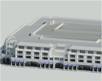
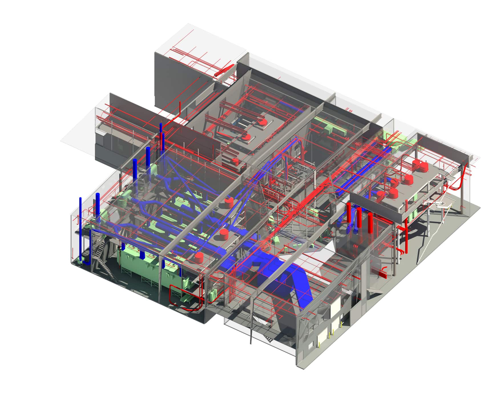
Scan to BIM
A pristine 3D model of your project allows you to see every inch of your space without having to be physically in the area. Design professionals can utilize these models to collaborate with team members no matter their location without fear of incorrect measurements, losing data, or experiencing team disconnect.
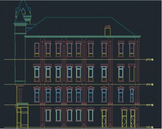
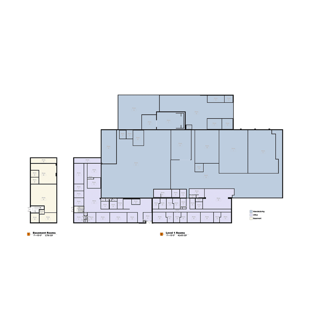
CAD Drawings
Architects and design professionals are often held up on new projects due to the lack of comprehensive and accurate plan sets. TrueScan can help alleviate these project woes through our detailed and precise plan sets, provided through our 3D laser scanning and 3D modeling services. Coupled with our point clouds and models, TrueScan’s plan sets allow design professionals to see an accurate and current blueprint of how a space is measured and sits in the field.
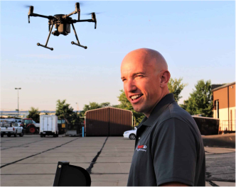
Drone Surveys
Scanning can come with a number of physical barriers and challenges. Whether it’s a dome-shaped roof, an incredibly tall building, or a sprawling campus, adding drone services, mapping, and photogrammetry can provide a more complete view of your project.
Matterport
Matterport’s all-in-one platform transforms real-life spaces into an immersive digital twin, producing high-resolution photo tours throughout any space. This information gives you and your design team the power to make concise decisions throughout your design process
As-Built Drawings
As USIBD-certified experts, TrueScan delivers precise 3D laser scanning and measurement services for as-built and existing conditions documentation.
BOMA Measurements
With a team of professional surveyors and USIBD-certified experts, TrueScan delivers precise 3D laser scanning and measurement services for as-built and existing conditions documentation.
Get a Free Quote
"*" indicates required fields
Get a Free Quote
"*" indicates required fields