
Hospital and Parking Garage Laser Scanning Project in Fort Wayne, Indiana
Fort Wayne, Indiana
Hospital and Parking Garage Laser Scanning Project in Fort Wayne, Indiana
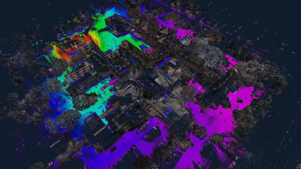
TrueScan provided 3D laser scanning services for the exterior of a large hospital and parking garage in Fort Wayne, Indiana to support a planned expansion.
The design team needed a detailed understanding of the existing relationship between building levels and important structural features. TrueScan captured the exterior conditions and delivered a point cloud tied to existing survey control so the data could be accurately incorporated into the project team’s Revit or AutoCAD files.
Project Facts
Location: Fort Wayne, Indiana
Property Type: Hospital and parking garage
Services:
- 3D laser scanning
- Exterior existing-conditions documentation
- Point cloud registration
- Survey control coordination
Size / Scope: Exterior of a large hospital and parking garage
Areas Documented:
- Hospital exterior
- Parking garage exterior
- Multiple building levels
- Columns
- Expansion joints
- Other structural features
Deliverables:
- Detailed point cloud
- Scan data placed on existing survey control
- Existing-conditions data compatible with Revit and AutoCAD workflows
The Challenge
The architects and planners were preparing for an expansion and needed to understand how the existing hospital and parking garage were configured.
Of particular importance were the spatial relationships between different levels and the precise locations of structural features such as columns and expansion joints.
Relying only on existing drawings could have left the design team without the level of detail needed to understand every area and angle of the existing space.
TrueScan’s Approach
TrueScan laser scanned the exterior of the hospital and parking garage to capture detailed existing conditions across the project area.
The resulting scan data was assembled into a detailed point cloud and placed on the project’s existing survey control.
This allowed the design team to import the point cloud into an existing Revit model or AutoCAD drawing in its correct spatial location and directly compare proposed work against current conditions.
The Result
The point cloud gave the architects and planners a detailed digital reference for understanding the relationship between building levels and locating important structural elements.
By working from scan data tied to established survey control, the design team could plan the expansion using a more complete representation of the hospital and parking garage than existing drawings alone could provide.


Get a Free Quote
"*" indicates required fields
"*" indicates required fields